|
WARNING - Many of the roofs, windows, hand-rails, underground magazines, etc. have been
collapsing, breaking, vandalized, rusting, filling with water, mud, dirt and who knows what
for
at least 30 years. Please look, no touch, from a respectful distance.
A 15 foot fall from a rusted out radar tower ladder onto a concrete pad
can ruin your whole day or life. Many old Nike sites are on private property and the owners
do not wish to be sued for more than they are worth
just because you are curious and careless.
Asking permission, CRASH !!, Suffocation, Attractive Nuisance Jan 2017 - Ted Swanson sent: Nike Hercules ? Python in Launch Bunker http://www.flkeysnews.com/news/local/environment/article128625164.html :-| A collection of pictures of abandoned sites from Richard Lewis |
The purpose of this page is to aid interested people
in finding the locations of old Nike sites world wide.
Oddly, or predicably, there are/were uncertainties about the locations of some Nike sites.
A Table of Contents:
Known Nike Ajax and Hercules sites, ranges, centers:
Alaska, Belgium, Crazyfornia-*, ColoradoSprings, Connecticut,
Denmark, Florida, FtBliss, FtChurchill, Georgia,
Germany, Greece, Greenland, Hawaii, Illinois,
Indiana, Iowa, Italy, Japan, Johnston Atoll,
Kansas, Korea, Louisiana, Maine, Maryland,
Massachusetts, McGregorRange, Michigan, Minnesota, Missouri,
NAMFI, Nebraska, NewJersey, NewMexico, NewYork,
Norway, Ohio, Okinawa, Pennsylvania, RedCanyonRange,
RhodeIsland, Sardinia, SeaRange, SouthDakota, Spain,
Taiwan, Texas, Turkey, Virginia, Washington,
WhiteSandsProvingGround, Wisconsin
Design & manufacturing of Nike Ajax and Hercules:
Bell Telephone Labs,
Douglas Aircraft,
Western Electric,
General Electric (HiPAR).
also Lat-Lon of U.S. Nike systems and command structure
sorted by Location
Are you confused by all the map datum options? Tom Page suggests:
- North American Datum
from Wikipedia
- Latitude and Longitude, Coordinate Systems
and Projections - NAD27 and NAD83
also - added December 2023
- U.S. and Denmark Nike sites
-
Wikipedia
As you might guess, Nike folks aren't the only ones looking at the ground for history. Here is an effort to find Low-Frequency Radio Ranges used to guide aircraft in the 1930s and '40s.
|
GOOGLE MAPS
- Germany and Italy
GOOGLE EARTH
US Nike and related sites, mainland, Hawaii, Alaska, Greenland -
all Italian Nike sites - from Tom Page, Jan 26, 2008
Korean Nike sites - from Gale Maxey < galemaxey@verizon.net > - May 13, 2012
a Spanish site - added August 2017
|
Please forward any GPS positional information to
Ed Thelen and I will put it on this web page.
The format is Latitude first, then Longitude as in nn.nnnnnn and mm.mmmmmm
Please use the Map Datum "WGS 84" - most GPS units are preset to this.
And on-line TopoMaps
spotted by Tim Tyler
"Here's an UNCLAS
example. It's zoomed in on the former Detroit Nike D-17 Sites. The "Area
Vocational Sch" explains a little bit about the appearance of the former
IFC compound ..."
Also, Donald E. Bender picked up on U.S. Army Corps of Engineer web pages in Alaska - Clicking on USACE in the description of sites below will link to the appropriate U.S. Army Corps of Engineer web page. These are currently in Alaska, but will be extended if/when more are found.
There was also a ring of Army radars around Chicago/Milwaukee
For the real experts on wide area surveillance radars go to North American Air Defense Online Radar Museum.
If you want a little fun, you can TerraFly about.
Using 'HistoricAerials.com' from Tom Page, July 2009, re Site C-08,09
|
The double IFC's (SF-08C/SF-09C) on San Pablo Ridge may be viewed at Lat 37.93932500 and Lon -122.27794722 by using the "Historic Aerials" website,
for the year 1959 (when Nike Missile Site SF-08 / SF-09 was active). ... The view in 1968 shows the sites after de-activation. |
Please Note: Much of the following U.S. Nike site location and current status is taken from "Rings of Supersonic Steel" and used with the kind permission of the authors Mark A. Berhow and Mark L. Morgan. (The information is arranged here by states rather than defense areas as in the original.) Also see Update Contributors.
Please also note: the information on this page is a small sub-set of the information in the book, which also includes site by site information of active dates, equipment and changes, military unit(s), maps, Defense Area Headquarters and radars, HAWK sites and general remarks.
Mark Morgan continues to travel and to collect Nike/ARADCOM history.
"I'm looking for personal recollections from former ARADCOM and
anti-aircraft personnel. Any location, any time from World War II to the
present, any specialty." His (new) address is:
Mark Morgan
607 White Oak Dr No. 1
O'Fallon, IL 62269
(618)628-3115
|
... there were
discrepancies in the ARADCOM site numbering system; my guess is it was a
function of the site planning, survey and acquisition process. ARADCOM
documents do put W-93 east of W-94.
|
|
Mark and gentlemen:
|
Sorted by Code rough sort on facility
| Site
Code | Defense Area, Comments | Site
Code | Defense Area, Comments |
| ... | Anchorage Defense Area (Alaska) | LA-nn | Los Angeles (California) |
| B-nn | Boston (Massachusetts) | LI-nn | Lincoln (Lincoln AFB) (Nebraska) |
| BA-nn | Baltimore (Maryland) | M-nn | Milwaukee (Wisconsin) |
| BD-nn | Barksdale (AFB) Louisiana | MS-nn | Minneapolis - St. Paul (Minnesota, Wisconsin) |
| BG-nn | Bergstrom (AFB) (Texas) | N-nn | Norfolk (Virginia) |
| BR-nn | Bridgeport (Connecticut) | NF-nn | Niagara Falls (merged with Buffalo in 1961) (New York) |
| BU-nn | Buffalo (merged with Niagara Falls in 1961) (New York) | NY-nn | New York (New York, New Jersey) |
| C-nn | Chicago (Illinois, Indiana) | OA-nn | Oahu (Pearl Harbor) (Hawaii) |
| CD-nn | Cincinnati-Dayton (Ohio) (Indiana) | OF-nn | Offutt (AFB) (Iowa, Nebraska) |
| CL-nn | Cleveland (Ohio) | PH-nn | Philadelphia (Penna. & N.J.) |
| D-nn | Detroit (Michigan) | PI-nn | Pittsburgh (Penna.) |
| DF-nn | Dallas-Fort Worth (Texas) | PR-nn | Providence (Rhode Island, Mass. ) |
| DY-nn | Dyes (AFB) (Texas) | R-nn | Robins (AFB) (Georga) |
| E-nn | Ellsworth (Air Force Missiles?) (South Dakota) | S-nn | Seattle (Washington) |
| ... | Fairbanks (Ft Wainwright & Eielson AFB) (Alaska) | SC-nn | Shilling AFB (- inactivated after 2 months) (Kansas) |
| F-nn | Fairchild (Fairchild AFB) (Washington) | SF-nn | San Francisco (Calif.) |
| H-nn | Hanford (Atomic "device" production) (Washington) | SL-nn | St. Louis (Ill. & Mo.) |
| HA-nn | Hartford (Connecticut) | T-nn | Travis (AFB) (California) |
| HM-nn | Homestead - Miami (after Cuban Missile Crisis) (Florida) | TU-nn | Turner (AFB) (Georgia) |
| KC-nn | Kansas City (Kansas, Missouri)) | W-nn | Washington D.C. (Maryland, Virginia) |
| KW-nn | Key West (after Cuban Missile Crisis) (Florida) | WA-nn | Walker (AFB) (New Mexico) |
| L-nn | Loring (SAC bases) (Maine) | . | . |
Site facility codes used are:
A - Admin facility
C - Control/IFC (integrated fire control
DC - Direction Center
H - Housing
L - Launcher Area
R - Radar facility
Site Status codes are
(I) - Intact; buildings, launch pads and possibly radar towers in place
(O) - Obliterated: all traces removed
(P) - Partial; some modifications or dismantling of buildings and launch facilities
My added codes are:
[ ... ] information sent to update/enhance the book's information
{name} contributor code, for Contributors details
*** - a headquarters.
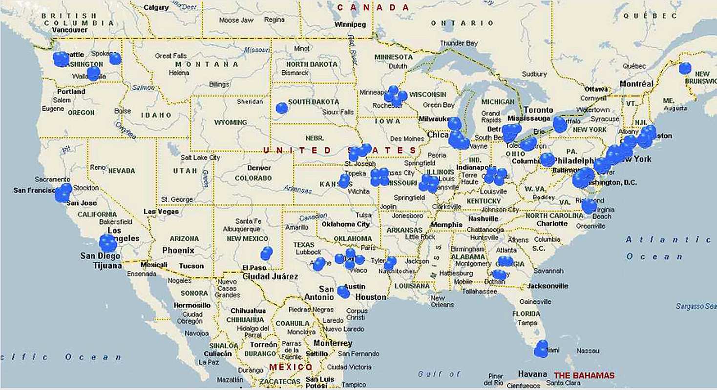
For maps showing many of these sites, go to
Maps showing Nike sites near U.S. cities
The following are firing batteries only - no area headquarters or radars listed. Sites that were surveyed but never built are not listed below.
Please note that the Nike defense system was ever changing during its life in the United States from 1954 until the "SALT" treaty in 1974 (1979 for Anchorage Alaska). Sites were constructed, equiped and manned, sites re-named, their units renamed, and sites were closed at a much higher rate than most people were accustomed to. (People tended to think that a military installation was as permanent as taxes, at least until recently.) Some of the reasons for the frequent changes were:
- The much greater range and power of the Nike Hercules which started replacing the Nike Ajax in 1959 reduced the number of sites required to protect a given area with the same effectiveness.
- Changing air defense priorities - example the Cuban Missile situation in October 1962 caused some re-location of some systems to quickly constructed above ground sites in Florida.
- Changing manpower commitments - moved some Nike people to Vietnam.
- Review of existing situations - such as the merging of the Buffalo and Niagara Defense Areas in 1961.
- The ever changing funding situation from congress, such as the 1970 defense cut backs.
Contributors & Locations they updated
100 % of the U.S. site information above originally came from
"Rings of Supersonic Steel" with the very kind
permission of the authors. ("RSS" has a lot more information including equipment,
years, dates, etc.) Since then, the following people have contributed
information and updates:
A,
B,
C,
D,
E,
F,
G,
H,
I,
J,
K,
L,
M,
N,
O,
P,
Q,
R,
S,
T,
U,
V,
W,
X,
Y,
Z
| Name | Locations Updated |
| A | |
| A.G. | Crazyfornia |
| Abbazia, Edward | Connecticut |
| Abernethy, Mike | Chicago/Milwaukee radar ring |
| Allen, Ron | Connecticut |
| Alvarez, Luis | Florida |
| Amelong, Bernd | Germany |
| Anderson, Erik | Washington |
| Anderson, Michael | Indiana |
| Anderson, Tyson | California |
| Anton, Ken | California |
| Aresu, Roberto | Capo San Lorenzo Range [Sardinia] Italy |
| Austersl?tt, Tor Willy | Norway |
| Azzollini, Robert | New York |
| C | |
| Cameron, James | Minnesota |
| Campbell, Bob | Missouri, Illinois, Florida |
| Carpenito, George | Pennsylvania |
| Carter, Charles | Florida - South Florida Web Site |
| Castelnau, Jorge | Florida - |
| Chiles, Sue | Missouri |
| Clarke, William | Alaska |
| Cocherell, Harold | Illinois, Wisconsin, Michigan,[text about radar ring around Chicago] |
| Conklin, Mark | Maryland |
| Coogan, Jack | Florida |
| Crossley, Gary | Maryland |
| Cuerdon, Matt | Korea |
| Cunningham, Jim | Illinois |
| Cymerman, Mark | Illinois |
| D | |
| Darrall, Mark | Pennsylvania |
| Dart, Dale | New York |
| Davidson, Marian | Colorado Springs |
| DeMarco, Peter | Alaska |
| Denja, Mike | Michigan |
| Deutsch, Elliot | Maryland |
| Devine, Brian | California, Massachusetts |
| Donovan, Mike | New Jersey | Doubleman, Phil | New Mexico, Hawaii |
| Dowdy, Glenn | Washington (state) |
| Dunlap, Ken | Michigan |
| E | |
| Edwards, Dale | Korea |
| Edwards, Tom | Minnesota, Wisconsin |
| Eichenlaub, John | South Dakota |
| Elonich, C J | Illinois |
| Emiliano, . | Italy |
| Enders, Rolf | Germany |
| Eric | California |
| Eriksen, Erik | Virginia |
| Erkelens, Ronald | Germany (Royal Dutch Airforce) |
| Etem, Blake | Italy |
| Etten, Sara, | New York |
| Evans, Bill | Maryland Nike web site |
| Evans, Richard E. | Greenland |
| Everett, Charles | Germany |
| F | |
| Faresin, Marco | Italy |
| Feldmann, Charles | Maryland |
| Fischer, William | Minnesota |
| Foster, Mark | Boston, Connecticut, Maine, Rhode Island |
| Foster, Robert | California |
| Federico, John J, Jr. | Greece |
| Fornash, John | Florida |
| Freak | Alaska |
| Freeman, Calvin | Michigan |
| Freeman, Paul | Maryland |
| Friedel, George C. | New Jersey |
| Froehlich, John | Alaska |
| Frost, Craig MVFD | New York |
| Fuller, Jon | Illinois |
| Funk, Dick | Washington |
| G | |
| Gajewski, Joe | Maryland |
| Gale, Mike | Pennsylvania, New Jersey |
| Gallery, Jerry | Nebraska |
| Gamerro, Rob | Pennsylvania |
| Gardner, Kevin | Alaska |
| Garreta, Lluis | Spain |
| Garver, Jason | Maryland |
| Gatto, Tim | Korea, Florida, author of Kimchee Days |
| Gearhart, Philip | Greece |
| Gibson, James A | Wisconsin |
| JC Gielen | Belgium, Germany |
| Giera, Allen | Ohio |
| Gilliss, Dave | New York |
| Goettlich, Walt | Germany |
| G?rigk, Rolf Dieter | Germany ( used to have 2 great Nike Hercules web sites ) |
| Greer, Lou | New York |
| Gregorios, John | Turkey |
| Griswold, Stephen | Connecticut |
| H | |
| Hammitt, Mathew | Minnesota |
| Hanchey, Jennings | Virginia |
| Handa, Dave | Washington (state) |
| Halinar, Karen | Illinois |
| Hankel, Carl | Maryland |
| Harris, Wes | Pittsburgh |
| Harris, William W. | Washington (state) |
| Hashash, Bruno | Pittsburgh |
| Harvey, Val S. | Michigan |
| Hathaway, Craig | Maryland |
| Hawkins, Joe, | California www.vaq34.com/ccc |
| Heck, Greg | Texas |
| Hedges, Christopher C. | Illinois, Indiana |
| Henderson, John | Maryland |
| Herbert, Edward R. III | Maryland |
| Herron, Marty | Ohio |
| Hintz, Les | Okinawa |
| Hirose, Paul, | California |
| Hiscox, George, | California |
| Hoehne, Don | Florida |
| Hobbs, Daemon E. | Korea - web site |
| Holdorf, David E. | Wisconsin |
| Horton, Don | Maryland |
| Hottel, Alan OV | Illinois |
| Houck, Larry | Washington |
| Housman, John C. | New York |
| Hranicka, Joe | Illinois |
| Hughes, Jim | Texas |
| I | |
| Ingram, David | Ohio |
| Innes, Jim | Pennsylvania |
| J | |
| Janesic, Joe | California, (webmaster, Fort MacArthur Museum -www.ftmac.org) |
| Jankowski, Andrew | Illinois |
| John | Massachusetts |
| Jonasen, Dean | Germany, Washington |
| Jones, Donnie Jr | Pennsylvania |
| Jordan, Jace | Ohio |
| K | |
| Kalderis, D. | Crete |
| Kallman, Ray | Virginia |
| Kaltofen, Marco, | Massachusetts |
| Kamienski, Roman, | California |
| Karg, Dan, | Minnesota |
| Karr, David | Alaska |
| Kastner, Derek | Virginia |
| Keilman, Larry | Indiana |
| Kerns, Terry | Alaska - RIP :-(( |
| Kilian, Robert | California |
| King, Jerome | Kansas |
| Kinney, Richard E., | Korea |
| Klco, Paul | New Jersey |
| Koch, Jim | Germany |
| Koch, Michael, | Maryland |
| Koedel, Tom | Pennsylvania |
| Koons, Weston | South Dakota |
| Kosmeder, Raymond | Wisconsin |
| Kotakis, Paul, | Greece |
| Kotakis, Paul, | Greece |
| Kramer, Chris | California |
| Kramp, Ken, | Maryland |
| Kraus, Andrew, | Florida |
| Krimmel, Karl | Michigan |
| Kuehn, Bob | Minnesota |
| Kurylowicz, Chris Krzysztof | Illinois |
| L | |
| LaFaye, Troy | Minnesota |
| Lagerstrom, Stellan | California |
| Larish, John | Pennsylvania, Massachusetts |
| Larsen, David A. | Maine, Massachusetts, New Jersey, Virgina |
| Laughlin, Kurt | Pennsylvania |
| LaVite, Tyler | Illinois |
| Layton, John | California |
| Lesky, Mike | Pennsylvania |
| Levine, Richard | New York |
| Lewis, Rich | Pennsylvania |
| Linhart, Bill | Pennsylvania |
| Lisa, Mark P. LT | Maryland |
| Lockman, Matt | Illinois |
| M | |
| MacDonald, David | New York |
| MacDonald, John | Conneticut |
| MacDonald, James F | Massachusetts |
| MacDonald, Raymond | Rhode Island, Ft. Bliss |
| Make, Brenda Ellen | New York, Conneticut |
| Mandeville, Paul | New York, Rhode Island, Pennsylvania |
| Marak, Rich | Pennsylvania |
| Markert, Tom | New York |
| Martin, Roy | Okinawa |
| Maxey, Gale L. | California, Ohio, Virginia |
| McAulay, George | Florida |
| McDonald, Mary Rose | Connecticut |
| McGrath, J. | Mass. |
| McNeill, Roy | California |
| Meuti, Alessio | Italy |
| Michalsky, Jay | Florida, California, Indiana |
| Mikkelsen, S?ren | Denmark, NAMFI |
| Miller, Keith | Germany, Kansas |
| Miner, Marcia | Conneticut |
| Mittermaier, Beth | Wisconsin |
| Moats, Ronald P | Ohio |
| Moore, J.P. | New Mexico (ranges), Kansas |
| Moore, Leonard (Tony), | California |
| Morin, Charles | Illinois |
| Morales, Robert | Virginia |
| Morgan, Mark, L. | co-author of "Rings of Supersonic Steel" which formed the basis of this web page (book has much more than here), California, New Mexico, Texas, Washington |
| Morgenstern, Aaron | Washington |
| Moses, Larry W. | Indiana |
| Motel, Corey J. | Illinois |
| Murdock, Scott | California, Connecticut, Florida, Georgia, Hawaii, Illinois, Indiana, Iowa, Kansas, Louisiana, Maine, Maryland, Massachusetts, Minnesota, Missouri, Nebraska, New Jersey, New York, Ohio, Pennsylvania, Rhode Island, South Dakota, Texas, Washington, Virginia, - WebSite USAF Installations |
| N | |
| Nagl, Roy | New York |
| Needham, Andre | Washington [state] |
| Neil, Jenna | Wisconsin |
| Newton, Brent | Maryland |
| "NikeSiteSearchers" | Mark Morgan, Scott Murdock, and Tom Page e-mailed back and forth extensively (over 300 e-mails) trying to locate US Nike and related sites, mainland, Hawaii, Alaska, Greenland (Thule) |
| David Novak | Illinois, Missouri, see web site |
| Norris, Rick | Florida |
| O | |
| O'Callaghan, Brian | New York |
| O'Connell, Dave | Taiwan |
| O'Donnell, Mickey | New Jersey |
| Ojarovsky, John | Conneticut |
| Olson, Thomas | California, Indiana |
| Osgood, Pete | Pennsylvania |
| P | |
| Packard, Doug | Washington |
| Page, Tom, | California, Maryland, New York, Hawaii, "Google Earth" US Nike sites |
| Parrich, Richard | Texas |
| Partington, Dennis K | Michigan |
| Peabody, Milton | New Jersey |
| Pellino, John A. | Conneticut |
| Pendell, Bob | Okinawa |
| Perale, Mirco | Italy |
| Perro, Walter D LRL | Illinois |
| Peterson, James D SGM | Alaska |
| Pettinari, John | Okinawa |
| Piland, Doyle | Indiana, New York, website Nike Ajax and Hercules Ordnance Support Units |
| Plante, Ron | Alaska, Minnesota, Washington, Kansas, Massachusetts, New York |
| Podgorski, Joseph | Indiana |
| Poehlein, David M. | Germany |
| Polmon, Dave | Connecticut |
| Poole, Rowen S. | Pennsylvania |
| Poskanzer, Jef, | California, San Francisco Defense Area Nike sites with a detailed page for each site. |
| Powell, Nick | Hawaii, Greenland |
| Proffitt, Bill J. | Alaska |
| Pumphret, Eric | Texas |
| Purcell, Alex | Conneticut |
| Pytko, Walter | Nebraska |
| R | |
| R, Marc | Maryland |
| Raichle, Bob | California |
| Rappange, Frank | Germany (Royal Dutch Airforce) |
| Ray, Jim | Washington |
| Revie, Charlie, | Georgia |
| Rhoden, Allie | Georgia |
| Ricks, Dave | Crazyfornia |
| Riggs, Daryl | Ohio |
| Rigney, Roger | Korea |
| Rishar, Dave (Ishtar) | Washington |
| Rivenbark, Burney | Florida |
| Roberts-Abel, Cate | New York |
| Roby, James | Korea |
| Roehrig, Robert | Maine, Kansas |
| Roggenkamp, Erik | Denmark |
| Rollins, Bert | California |
| Rovner, Jan | Minnesota |
| Rubbo, A. | Virginia |
| Runkle, George | Pennsylvania |
| Rusher, J | Okinawa |
| Russell, Gregory | Illinois |
| Ruth, Dennis | Virginia |
| Rzeznik, Jon | Wisconsin |
| T | |
| Talley, Jim | New York |
| Tamburello, Joseph | Hawaii |
| Tannucilli, Anthony P. "Tony" | Maryland, New Jersey |
| Taylor, Howard | Virginia |
| Tesar, Dan | Nebraska |
| Thelen, Ed | Illinois |
| Thompson, Ted | Maryland |
| "Tim" | California |
| Torrance, Hank | Maryland |
| Tow, Jerry M | New Jersey |
| Treib, Bill | Indiana |
| Tseytlin, Anthony | Washington |
| Tufts, Patrick | California |
| Turner, Dayle K. | Hawaii |
| Turner, Jon | Kansas |
| Turner, Kenneth A. | Georgia website |
| Tyler, Tim, | Maryland, Michigan, California, Texas |
| U | |
| Usher, Richard (Rick) | Wisconsin |
| V | |
| Vadnais, Ed | California |
| Vaughn, Tom | Florida, Illinois, Indiana, California, Maryland, Nike web site |
| W | |
| Wallace, Roy | New Jersey |
| Warren, Jim | Alaska |
| Warren, Mark | Virginia |
| Weber, Mark | New York |
| Welshans, Terry | Illinois |
| White, Aaron | Korea |
| Whitaker, Jim | Florida, story Cuban Missile Crisis |
| Williams, Christopher | Texas |
| Williams, Chuck | Korea |
| Willis, Nate | New York |
| Wilson, Doug, | Ohio |
| Wisz, Ken , | Korea |
| Woida, Carl, | Illinois |
| Wong, Richard, | Maryland |
| Woodbury, Tom | Korea |
| Worrell, Bill | California |
| Wright, Dan at Rolnick Observatory | Connecticut |
| Wroblewski, Brian, | New York |
| X |
| Y | |
| Yeager, Dorian | Washington |
| Z | |
| Zimnickas, Jeffrey | Michigan |
----- Original Message -----
From: -
To: ed@ed-thelen.org

Ed,
    I want to photograph the old Nike Site PH-58 in Swedsboro, NJ.
I was wondering if you ever got permission to do that
  and who you contacted to get permission?
Thank You

- -

The very few (maybe 8?) old Nike sites that I have
photographed were on public land in California and Illinois -

It is considered polite, and is often advantageous,
    to get permission from the owner.

I am told of property owners/guardians who gave requesting visitors
    much more complete tours, under pleasant conditions,
    than the usual "gorilla" sneak in and
    watch over your shoulder tactics.

    (If your not looking where your going
       your even more likely to get hurt.)

There is even some self interest in a land owner
   giving you a nice tour and photo op.

  a) you the guest are less likely to bust in
     and get hurt and sue

  b) if you publish the photos,
      it is  less macho for someone else
      to do a gorilla and getting hurt

(I know that asking might not be as challenging,
   but I chose other challenges,
   and am now slowing, creaking and lazy  ;-)

I am CCing Mark Morgan who has visited many
  U.S. sites for his impressions

In this case, easy way is often the best way ;-))
     Ed Thelen
|
CRASH !! - received March 2011
|
Hi Ed,
We?ve recently corresponded several times about MD/DC area Nike sites. I?d like to re-iterate something that I know you?ve addressed at length on your web site, namely safety. I?ve spent the last six weeks in a walking cast thanks to my own blithe disregard of safety factors on a certain ruined Nike site. My own story doesn?t bear telling, mostly because it is too easy to imagine: I took a Stupid Risk and got for my trouble something called a Jones Fracture. By the grace of God, I was able to simply walk out and drive myself to the hospital. Anyway, the thrust of my emphasis is thus:
|
|
Harold Sprague mentioned:
I thought that I would add an additional concern when entering abandoned confined spaces. There have been instances where old concrete pits have been accessed. There is a mold that grows that consumes oxygen and the volume belt high and lower can be predominately CO2. I have known people entering a valve vault and passed out after very short exposures. If there was no confined space entry protocol, there was no one to rescue the person and they died. It did not take that long for them to die in that environment.
Ed Thelen's remark ;-)
|
|
An attractive nuisance.
I thought you might enjoy this article of a man who fell into the elevator sump at my old site, LA-88
Many YouTube videos of kids going inside.
These magazines were built before confined space protocol was recognized.
Greg Brown When the US Army abandoned the LA-88 Nike Missile site, they sold the property to the State of California for $1.00. The State used the property as a California Conservation Corps Camp for a dozen years. Then the State turned over the property to Los Angeles County, which used the launcher area as a Sheriffs training facility. The many YouTube videos have been made of the site that have only attracted more people and vandalism to the area, but the fact that this was an underground storage facility for nuclear missiles makes it a public safety danger. The underground storage areas have deep sump pits and present fall hazards along with rodents and snakes. The LA-88 Launcher area should be completely demolished and the underground missile magazines demolished, or filled with sand. The Vault access doors welded shut, or completely leveled and the remaining buildings leveled, and the whole area returned to the original pristine condition that it was found in before 1956. Los Angeles County has not been a good steward of the property, Nor the LA County Sheriffs who used the area as a training facility and left it trashed, along with an abandoned school bus on the site that is an eyesore and a public safety nuisance. The US Army also shares responsibility for any environmental damage that occurred during the operation of the Base, formerly known as Battery C, 4th Battalion, 65th Air Defense Artillery, LA-88, Los Angeles Defense, from 1956 to 1974. This was a former military installation. There were 120 personnel stationed there for a 20 year period, and was our First generation missile defense system. Please honor the veterans like myself who served there and clean up the broken down graffiti covered ruins that one was a proud component of the cold war. Respectfully yours, Greg Brown, former Nike Hercules Missile Crewman, LA-88, 1969-1971 |
If you have comments or suggestions, Send e-mail to Ed Thelen
Return to Home Page Return to top
Updated March, 2023