Maps showing Nike sites Back to Home Page
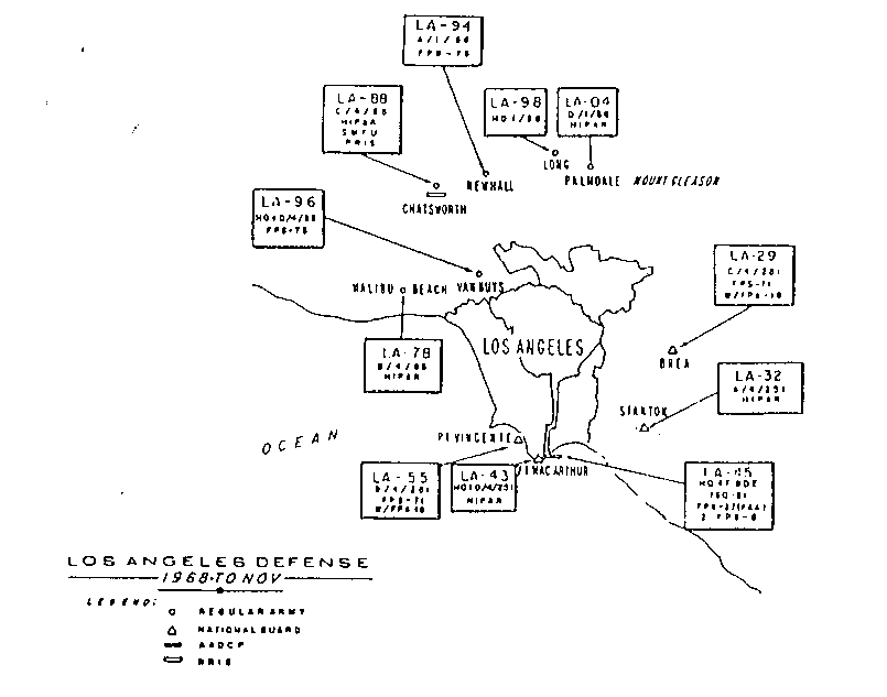
- Map of past Nike Sites around Los Angeles - courtesy Rick Rather
- - Rick points out that his map is launcher-centric
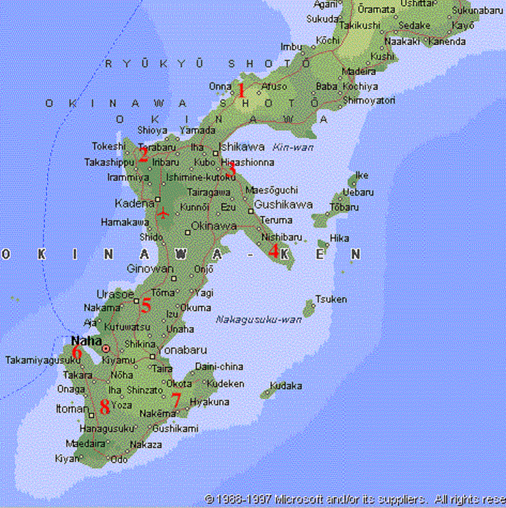
- Map of past sites on Okinawa Map base from Microsoft Encarta Virtual Globe 1998, Nike site locations from Japanese book published by the TAIHEI SHUPPANSHA (literally "Peace Publishing Co".) in July of 1968. It was edited by NAKANO Yoshio and entitled "Okinawa Mondai o Kangaeru" (Lit: "Considering the Okinawa Problem"). Map from book forwarded by John Purves, web site.
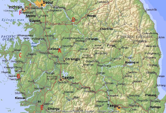
- South Korea 98 K bytes, U.S. Army Nike sites only, an estimated 8 ROK sites not shown, locations unknown. Map base from Microsoft Encarta Virtual Globe 1998.
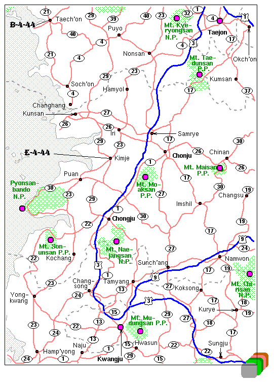
Detail location of sites B and E, 31 K bytes, from George Carmack.- Some sites in Germany from http://www.xs4all.nl/~erkelens/squadronmap.html
- Locations of former Nike sites in Germany from http://goerigk-jever.de/index.html
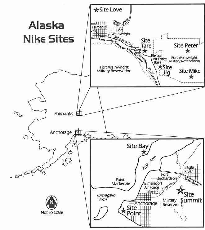
- Alaska
Please note: there were other Nike sites not included in these maps. These include smaller areas such as Nike protection for individual SAC bases. At some future date I may include the entire list.
The following area maps were current in 1968, see notes below.
For further site details get "Rings of Supersonic Steel" .
Please Note: the following maps are for major defense areas. For a more complete listing of Nike sites in the United States go to LOCATIONS OF FORMER NIKE MISSILE SITES (text)
Use your brouser's "Back" button to return to this page from a map.
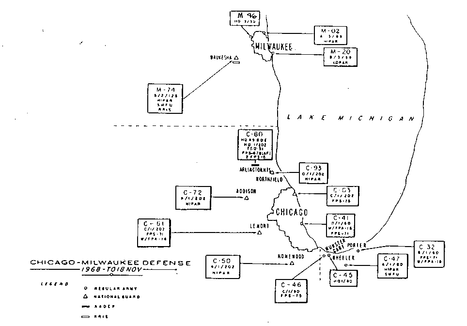
Chicago-Milwaukee
(Extra radar ring around Chicago-Milwaukee) (the radar sites were near the 10 red cities - warning 146K bytes)
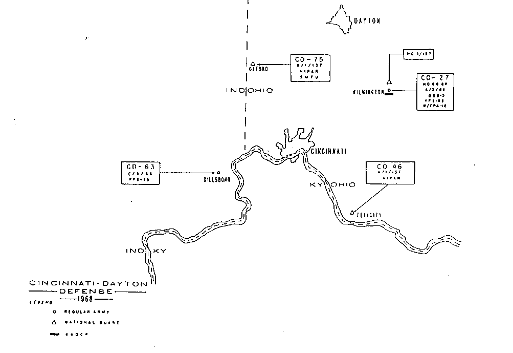
Cincinnati-Dayton
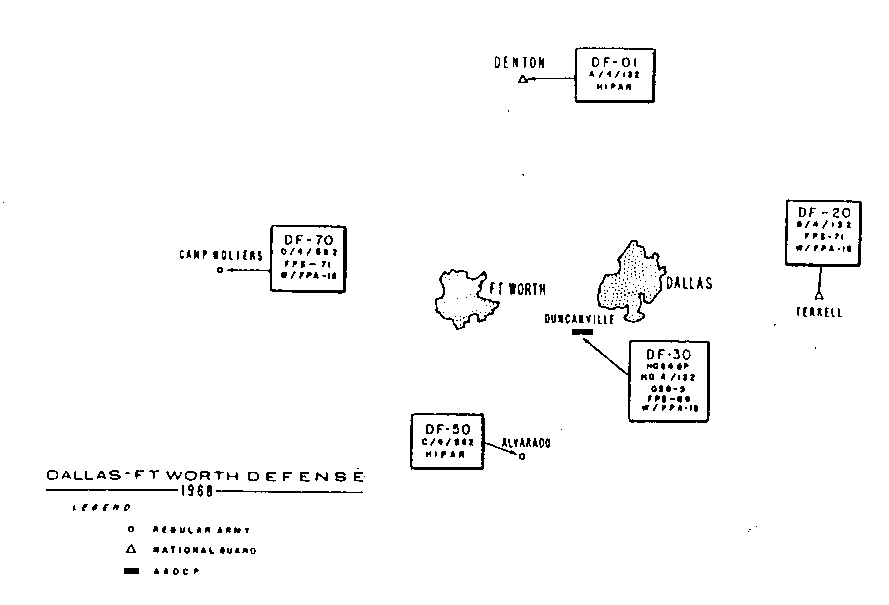
Dallas-Ft. Worth
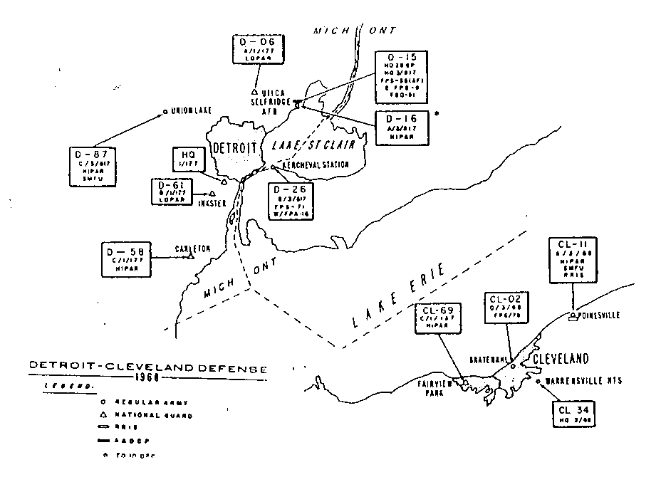
Detroit-Cleveland
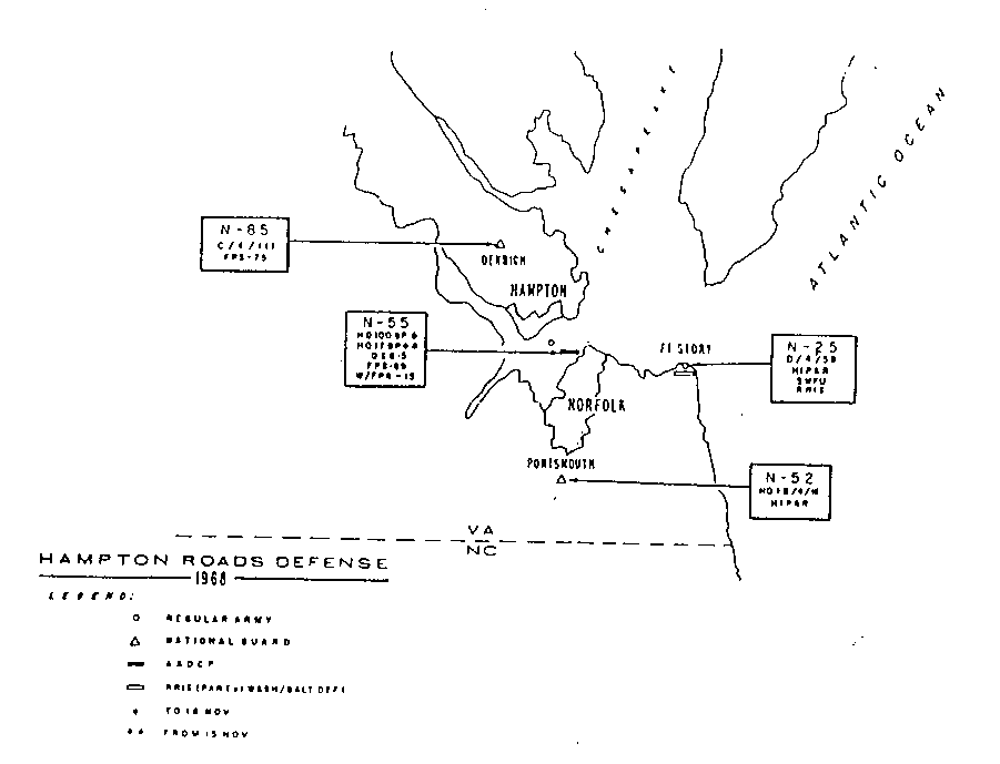
Hampton Roads-Norfolk
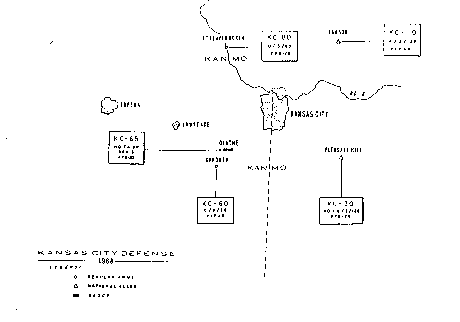
Kansas City
Key West
Los Angeles
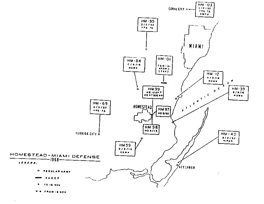
Miami-Homestead
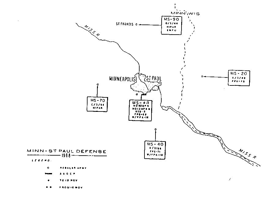
Minneapolis-St. Paul
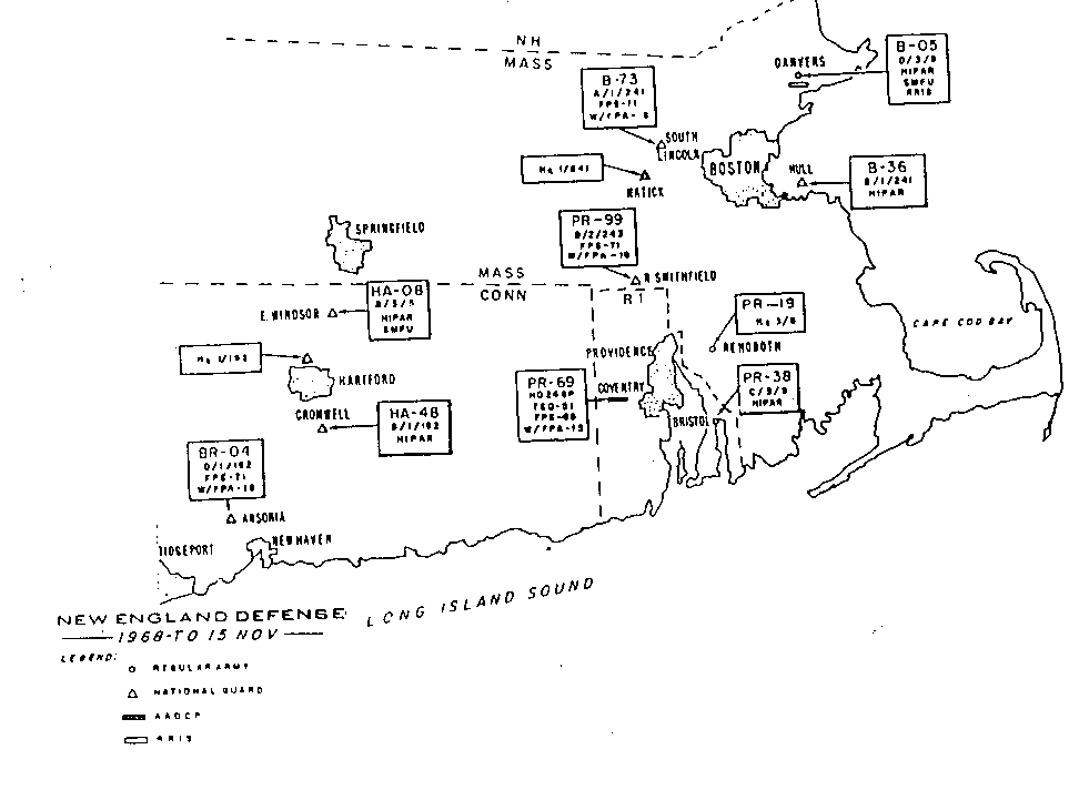
New England
New York-Philadelphia
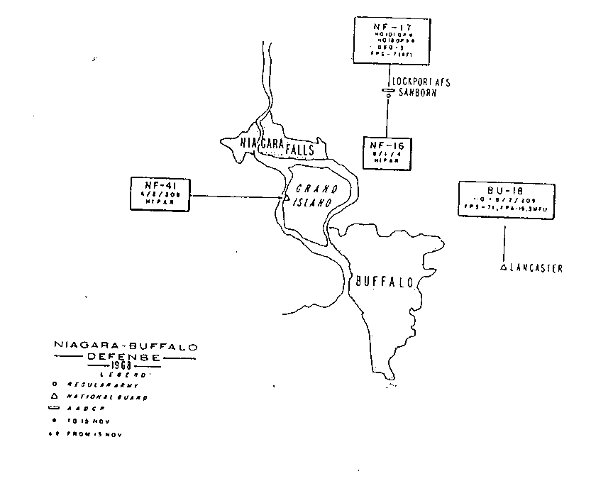
Niagara-Buffalo
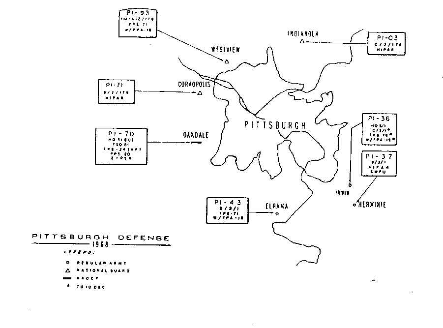
Pittsburgh
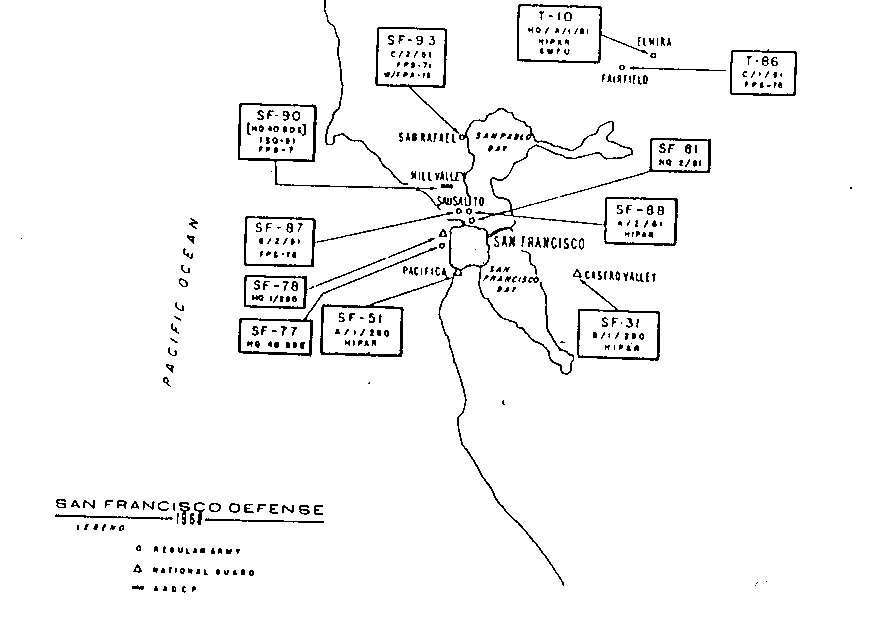
San Francisco
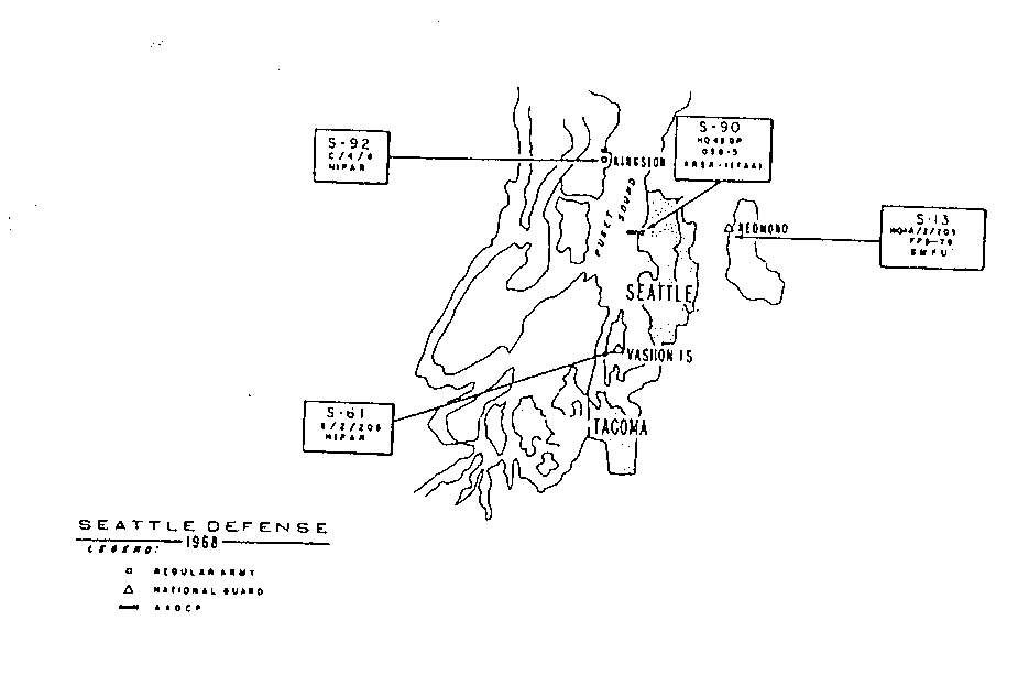
Seattle
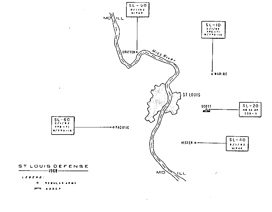
St. Louis
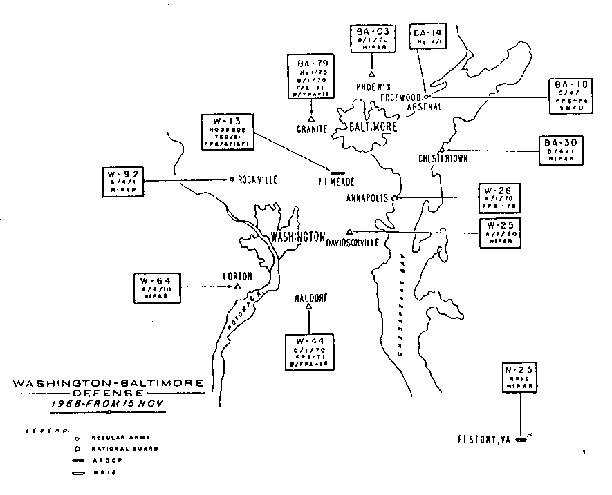
Washington-Baltimore
The above city and area defense maps were taken from Appendix B-3 of
"Historical Overview of the Nike Missile System"
by B.N. McMaster, J.B. Sonbee, W.G. Fraser, K.C. Govro, C.F. Jones,
A report prepared for:
U.S. ARMY TOXIC AND HAZARDOUS MATERIALS AGENCY
Assessment Division, Aberdeen Proving Ground, MD 21010
Ordering informationThe following text precedes the maps in section B-3.
"The documents contained in this Appendix have been reproduced from the best copies available. Although certain portions are illegible, this material is being released in the interest of making available as much information as possible.The maps presented in this section show the location of ARADCOM sites in CONUS as of 1968 and gave certain information about the unit and equipment at each site. the top line in each box gives the COE designation for the property, such as LA-04. The second line is the military unit designation (for example, A/4/65 to indicate A battery, 4th Battalion, 65th Artillery). HIPAR for high-power acquisition radar, and HAWK for a Hawk missile battery. The other codes have not been identified.
Personnel at the NORAD History Office in Colorado Springs, Colo., provided the maps presented, which were included in an annual historical summary report produced in 1968. Similar maps could not be located for other years."
Back to Home Page
If you have comments or suggestions, Send e-mail to Ed Thelen
Updated Oct, 2012